As an Oregonian, I have grown up hiking because of all the easy access to nature and the many varying climates and geography that exist in the state, from dense forests to dry, rocky landscapes. Hiking provides me with a great way to explore Oregon’s nature, as well as a good source of exercise. Here’s a list of all my favorite hikes I’ve discovered in Oregon.
Angel’s Rest
This is one of my favorite hikes due to its proximity to Portland and relatively short distance and moderate elevation gain, making the hike not super difficult. The only real downside is that this hike is always packed, no matter when you go. This hike traverses through forests, with occasional views of the Columbia River and the Columbia Gorge. There is also a waterfall and a bridge over a stream that you pass about a mile in. The hike ends at the top of a rocky promontory, with stunning 360 degree views of the Columbia River Gorge. I would recommend this hike for something easy to access and for a quick trip out of the city and into nature.
This hike is 4.8 miles roundtrip; to access it take I-84 East to the Bridal Veil exit.
Eagle Creek
Another popular hike along the Columbia River Gorge, Eagle Creek, consists of a relatively flat trail extending alongside a river in a slot canyon below. This eventually leads to Punchbowl Falls two miles in, with a small waterfall with a swimming hole below it and plenty of rocks to sunbathe on. I especially prefer this hike in the summer as water drips and trickles down off the rocks, keeping you cool. Then you get to cool off in the icy water at the falls after getting hot and sweaty during the hike. I would recommend this hike because of its impressive canyon cliff side and moderately easy access to a stunning waterfall. Luckily, because you do have to hike in, it significantly limits the number of people at the falls, preventing it from being overcrowded. The entire hike is 25.8 miles and eventually leads to wilderness, although I have never continued along the trail this far.
This hike is 2 miles one way to punchbowl falls. To access this hike, take I-84 East to exit #41.
Trillium Lake Loop Trail
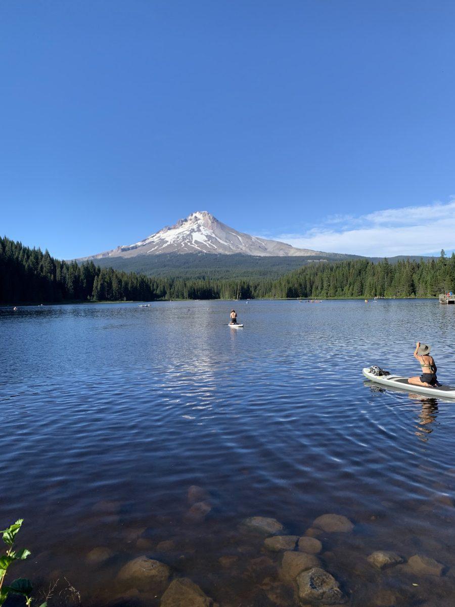
A more recent discovery of mine, this hike is perfect for either winter or summer. In the summer, the hike consists of a flat loop around Trillium Lake with massive views of Mount Hood with grassy, sandy, and rocky spots to stop and jump in the lake, which does not allow motorized vehicles. The lake itself is usually bursting with families during the summer, but the hiking trail is relatively empty. I would recommend hiking to the other side of the lake for prime swimming and lake access without swarms of people.
I recently hiked this trail in the winter while there was lots of snow, and I highly recommend it. In the winter, the road that drives down to the lake is closed, so it instead functions as a hiking, snowshoeing, and cross-country skiing trail that leads to the lake. I especially recommend it for an easy hike in the snow without needing any snow gear, such as snowshoes or cross-country skis, although you can use them. The hike ends at the lake, and if it’s cold enough and the ice is solid, you can even walk across the frozen lake. Thankfully, the view of Mount Hood is ever-present in winter, just as it is in summer.
The hike around the lake is 4.4 miles round trip. To access this hike, take US Hwy 26 East to Trillium Lake Loop Road (near Timberline Lodge).
Smith Rock State Park – Misery Ridge and Summit Trail Loop, Crooked River Trail
Even though the hikes at this state park are very well known, no list of Oregon hikes would be complete without it. Smith Rock State Park is exactly what it sounds like, massive rocks and cliffs surrounded by a river. There are two main hikes, one difficult one that goes steeply up, over, and down the sheer rock, and a much easier one that goes around the base of the rock. The hike going up and over the rock is hard as it starts with an approximately one mile steep climb straight up the rock. Once at the top, there are panoramic views of the surrounding river and high desert landscape. You will also walk past Monkey Face, a chunk of rock that looks like a monkey’s head. Next, the hike includes a steep descent down the rock and, finally, concludes the loop by going along the river until reaching the steep ascent, at which point you cross the river and walk up a short final walk uphill to the parking lot. The hike is popular among hikers and rock climbers.
The Crooked River Trail is my personal favorite, and it is a much more mellow trail that goes along the base of the rock that towers high above you. It also follows the river for most of the way. This hike seems to be less popular than the steep hike and is much easier, plus it gives you access to a couple of lovely sandy spots at the river’s edge.
The Misery Ridge and Summit Trail Loop is 6 miles roundtrip; Crooked River Trail is 4.5 miles roundtrip. To get to Smith Rock, take US Hwy 20 to Terrebonne and follow the sign to the State Park.
Deschutes River Recreation Area
Every year for Memorial Day weekend, I camp at the Deschutes River State Park because it is relatively close (only a 2 hour drive from Portland that is scenic the entire way because you drive along the Columbia Gorge to get there), and I can nearly always rely on it to be sunny when Portland is gloomy gray. There are multiple hiking trails that start at the campground. My favorite is a long, wide gravel trail that was once a railroad track and today is a trail that follows above the Deschutes River and offers views of golden hills, sagebrush, and basalt cliffs. The trail enters the Wild & Scenic River designation area. This trail is also great for biking. The trail is almost completely flat, but I love it because I can soak up the sun and views of the river for 22.1 miles one way. Beware of rattlesnakes though— I see them every time I go!
To access this hike, take I-84 East and continue for 12 miles past The Dalles to the Deschutes River State Park exit.
North Umpqua Trail and Pine Bench Trail
I consider this hike to be one of Oregon’s hidden gems, as I’ve never encountered more than two other people doing the hike. From the trailhead, there are two different hikes. The first follows a narrow trail above the river, leading you through the forest the entire time. Although the hike follows along the river, it definitely has a few hills, although I would not consider this hike to be very strenuous. Sadly, much of the North Umpqua Trail has been badly burned, but not here. The second hike from the trailhead, the Pine Bench Trail, goes up and almost immediately enters the Boulder Creek Wilderness. The hike passes through a variety of scenery, including forests, grasslands, rock outcrops, and small streams and rivers. This is a personal favorite hike of mine due to the super easy access to a wilderness area and the complete lack of people along the trail. It can be brushy though, as so few people hike it.
The North Umpqua Trail is 69 miles one way with 12 trailhead access points; the Pine Bench Trail is 8.8 miles roundtrip. To access these hikes, go to Roseburg and then take OR-138 East.
Arch Cape Trail
This is my favorite hike along the Oregon coast. This hike starts as a mellow path through a dense forest of Sitka Spruce trees and waist-high ferns. After about a mile, the trail reaches a cliff overlooking the Pacific Ocean. The trail continues along the cliff, offering stunning views of the ocean in the background and waves dashing and frothing against the rocks in the foreground. I recommend this hike because of its relatively easy difficulty and stupendous coastal views. Be warned, though, I once hiked this trail mid-winter and it poured the entire time. I slogged through thick mud (that also swallowed my little shivering 14-pound Havanese). By the time I reached the viewpoint along the coast, the winds were so ferocious that I opted to turn around rather than continue slamming my body into the wind along the ocean’s edge. I recommend going on a day when it’s not raining and the weather is a little more mellow.
This hike is 5.5 miles round trip. To access this hike, take Highway 26 West until its intersection with Highway 101 and then take 101 South until you reach Oswald West State Park.
Overall, these hikes vary in difficulty as well as scenery and encompass my favorite geography and landscapes all around the state. If you ever decide to do any of these hikes, I hope you enjoy them as much as I do!

